Tuesday, April 16, 2013

Ramblin' Rose Ambassador


 So, I'm really excited to say that I am an ambassador for the amazing Ramblin' Rose Triathlon series based out of North and South Carolinas!

After running my first marathon in January, I vowed that my goal in 2013 was to do my first triathlon. After moving to North Carolina, I searched for different triathlons that were very simple yet would challenge me to train for it. Any race with a swimming event over 400 meters scared me. Yes, I've swam in the ocean quite a lot but not in a race style. After swimming laps in the local pool it was clear to me I needed something much, much smaller. This is when I found the Ramblin' Rose Race series. I LOVE that it really focuses on celebrating active and fit women. It's hard to believe that a women had to sneak on to the Boston Marathon, just shy of 50 years ago, to actually prove that women could be capable to run just like men. Now, there are races gauged specifically for women!

I'm not sure which race in the area I'm going to run, but I know it will happen this summer.

Here is a listing of the races

South Charlotte Tri
May 5, 2013

Raleigh Tri
May 19, 2013

Rock Hill Tri
July 14, 2013

Winston-Sale Tri
August 18, 2013

Charlotte Tri
September 22, 2013

Chapel Hill Tri
October 6, 2013

It's a VERY, VERY achievable event for even those who are beginners in the Triathlon event or are trying to achieve a personal record in each event

The actual events include :
Here is the link for the actual website and other sites that hold more information for each race day and other news and events:

Ramblin' Rose on Twitter

Ramblin' Rose on Pinterest (this has some really awesome inspirational and motivational running quotes, I would really suggest checking it out!)

Ramblin' Rose on Facebook

Ramblin' Rose Website

I plan on updating this website with photos as well as updates of the different races.

From this picture I found on the website, it looks like spots are filling up pretty fast!


Now, Keep in mind this is as 3/31/13, So, if you're interested you might want to sign up early to confirm a spot!


Saturday, April 13, 2013

The Active Choice 5K- Boone, North Carolina


This race was a combination of running on the local Greenway and part trail running. I didn't realize until we were running, the reason why we didn't continue on the Greenway was due to another race happening just north of us. I was running and saw this mass amount of people and was instantly confused! I knew there weren't that many runners with our race but understood it was a different group with the difference in bibs.

This 5K was organized by the Health and Science club, as well as the Physical educators and Exercise science club at the local college. I thought the logo for the race was pretty neat!

It was SUPER cold at packet pickup this morning. The sun was out and it looked like a beautiful day but I think by the time we were running it was only 43 (COLD!). I was very glad I didn't wear shorts.

The course began on the Greenway but made it's way up a pretty steep and gravel trail after the first mile.

The 2nd hill kicked my butt! with the combination of the cold air in my lungs and the hill, breathing was very difficult for me. I was holding an amazing pace, first mile was 8:41 but quickly slowed once I hit the hills.4 people then passed me and I never regained my lead I had.

After mile 2 I knew there was going to be a decline and was anxiously anticipating it. Down the hill I picked up speed and was constantly gauging my speed and my feet placement on the gravel to avoid slipping.

Mile 3 was across a grassy part of a soccer field and then the home stretch. After crossing the chalked finish line It took quite a while to regain my breathing. My lungs were burning from the cold air  and I had really pushed myself faster than I usually do (the curse of the 5K sprints...as I call them)..however after a bagel my were no longer on fire and I could regain normal breathing.


Surprisingly I was awarded the 2nd fastest time in the women's 21-30 age division. It was small race but I still wasn't expecting it.

I also won a Gift certificate to a local grocery store...wahoo!


Josh took off and I only saw him once other time during the race. He ended up being awarded 2nd place in the overall race


It was a successful 5K.

I like 5K's, it was the start of my whole running "career" but.. I also HATE THEM. I have SUCH a competitive outlook on smaller races and so I ended up pushing myself harder than I have trained and they end up more like sprints for me. These next few months of training will be more focused on speed and hills instead of just a flat distance training like last year. I have proven I can do long runs, now I just need to fine tune them so I can push myself more.

:)

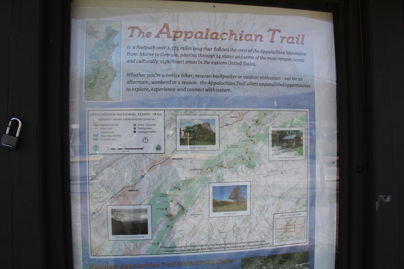
A Day Hike on the Appalachian Trail-Damascus Virgina


Since moving to my new residence, I've really became compulsive about the Appalachian trail. I never knew existed until this move. I've heard of the Pacific Crest trail, but when living close to it, I wasn't very active I quickly dismissed the idea of even finding it. I feel as if I've gone to the library and checked  out almost every book on the Appalachian trail as well as buy one book every 2-3 weeks on amazon that hikers have written about their thru hike. Those books being:

AWOL on the Appalachian trail -David Miller
A Walk in the Woods- Bill Bryson
A Journey North- Adrienne Hill
Backpacking for Women-" "
Day Hiking on the Appalachian trail- Louge & Adkins

There are more out there...but I've been slowly devouring them, one at a time, since March.

After going to the local city information desk, I found that I was a very quick drive to Damascus, Virgina. One of the biggest, and sought after trail towns on the southern side of the AT.

This past week was one of the warmest days it had been so, I jumped on the oppourtunity to go!

The city itself is a very sleepy summer town. I was expecting there to be me more of a town. However with a few gas stations and one stop light, unless you were there specifically for the AT or the Creeper trail (more on that later)..you would blink and dismiss the city as very comparable to the small town of Mayberry from the Andy Griffith show.

Upon arriving we decided to drive through the city and get an overview ( this took about 5 seconds). Of course we arrived at a park that was the southern entrance of the city. I jumped out of the car, I was so excited to actually see the evidence of the trail!


It's not an extremely exciting entrance but I'm sure a very welcoming one to a thru hiker ready for a hot meal and a day of rest.

There are 2-3 hostels/hiker's inn's I saw as we drove along the city streets. Next we hit the 2 outfitter stores just to drool over, over priced hiking items. It was neat to see.

At the edge of town we saw our 2 options for food, a local coffee/sandwich shop at Mojoes or a Hamburger at Jeepers Creepers. I'm really sad that we didn't see the Jeeper's Creeper's stop first. I had watched the National Geographic documentary about the AT and they feature the JC hamburger place in the show. However our sandwiches from Mojoes were amazing...AND we had the pleasure of conversing with a thru-hiker. He was retired and had started hiking from GA March 1st. We were very impressed with his speed! He had taken a 0 day yesterday in town, leaving at noon the next day, aiming to make it 15 miles .

After loading up it was time to hike! I had found a PDF on the Damascus website that had offered 4-5 4-8 mile hikes around the AT. I had seen a bridge coming into town marked with the AT on it, I was dead set to start with it, plus it was the beginning of the AT heading north out of town.

We parked our car at Mojoes and hiked on the side path that is part creeper trail, part AT.
                                                        (turned around and took this picture) This is what the thru-hikers coming the North would have been greeted with.

                                                                       And....we're off!

The first 2 miles from this bridge..were pretty killer. Other than a hike I had done in Hawaii, this ranks as one of the HARDEST climbs . It was a consistent incline with lots of rocks you had to avoid slipping on. I had to take 3-4, 5 second breathing breaks.  But I couldn't help shout WHITE! and slap every blaze we had passed

                         I was so excited to finally be on a part of this trail I had read and read about

                                                        It was a beautiful day!

It's still not quite spring up here in the mountains, I can't wait to revisit some of the trails, just to see the blooming of the flowers and trees!

I had great directions I had found on the PDF and the trail was very well marked. We hiked for another 2 miles on the trail and turned right to loop back to our car, back on the Creeper trail. I was sad to say goodbye to the AT but was very excited to hike on it.

The Creeper trail is a 33-34 mile trail that seemed more famous/ advertised in Damascus. Local bike shops/rentals will shuttle you and your bike/rental, on this gravel path that starts around Abingdon, VA and intersects Damascus. This trail is very pretty, and does run beside a river, but It's more for the bikes, less for the hikers. It seemed to be a long, slow, and flat 5 miles back to the car.


I ended up getting knee high in the river and cooling off my legs. I was having some shin pain from the constant hiking that week.

We spent the last mile of the hike discussing a smoothie choice from the Mojoe's cafe but was sadden when we saw it was closed before got back. We drove to another ice cream place and was also met with a "closed" sign. After talking to some local's we found the Dairy King and rewarded ourselves with a chocolate/Vanilla twist cone. It was amazing!

So excited to set foot on the historic and iconic AT trail. It won't be the last time we meet!

Trail Info:
Loop hike on the
Appalachian and VA
Creeper trails (8 mi. easy
to moderate):
Beginning in Damascus,walk east on the Appalachian and VA
Creeper Trails (white blazes). At the “Appalachian Trail” sign, turn left, cross Rte. 58/91 and ascend a set of steps, following the white blazed A.T. four miles, across ridges with views. Cross a small log bridge and turn r ight on the Beech Grove Trail (unblazed woods road) to reach Rte. 58 in ¼ mile. Cross and descend to the Straight Branch VA Creeper Trail parking lot. Turn right on the Creeper and walk four miles, with views of the creek, to return to Damascus.
 
The beginning of the hike was more moderate while the end was easy. With a pace of 3 miles per hour, we had, we found out it was more like 9 miles. 

Wednesday, April 3, 2013

Color Run 5K- Nashville, TN

 This was my first Color run, well walk. It's not so much of a run. There is no timing/chip and it is more enjoyable if you walk and take your time through each station. The goal, get as messy as you can!

Some people asked us if this race was a gay pride/awareness thing.  I pulled this from the Color Run website it's self:

ABOUT US

The Color Run™, also known as the Happiest 5k on the Planet, is a unique paint race that celebrates healthiness, happiness, individuality, and giving back to the community.
The packet pick up was in the Opry Mills Mall. I was pretty impressed with the ease of it. Waiting in line, getting the bag and shirt, took about 3-4 minutes. That evening wasn't as easy. The hotel we had rented a room from was about .9 miles away from the stadium. Being a part of other races,I have learned that the morning of the event is sometimes more stressful than the actual race. Well...with 4 of us planning to stay in a room, they only room they had available had a king. We had booked a double but, that's the joy of Priceline. The front desk worker wasn't too polite, so, we roughed it 1 couple in the bed, 1 on the floor in a sleeping bag, worked out just fine.

Packet Included:
  1. White color run shirt ( I liked mine so much I ended up wearing another white shirt the day of so my race shirt wouldn't get ruined)
  2. White color run headband
  3. 2  color run temp tattoos (I put one on my cheek)
  4. Bib
  5. Safety Pins
  6. Arm bracelett
  7. Color packet (to be opened at the end of the race)
Dress Attire- Everyone wears a white top, whether it be the color run shirt or just a plain white top. Everything I wore got color run on it (including an under tank top) SO just prepared to get color in places you don't expect....My feet still have color on them from inside my shoes!


The morning of we blasted Space Jam as our pre-race jam and got our white on. Within 10 minutes of walking to the stadium a lady, with a color run shirt on, offered us a ride. Gotta love good race karma. Upon following the herd of people , like sheep, we found the beginning of the race (but couldn't help pose by my favorite color)

The place was packed! My bib # started with 40,000 but I didn't think it was a real number ( it looked like a pretty standard bib they used/reuse at other color runs)..but.. After seeing the amount of people, I could believe it.


After meeting family in the back, we waited...and waited...and waited... Our wave of people didn't make it to the start line until an hour and fifteen minutes after the start of the race. There was an elevator and stairs , off to the side, that took you to part of the route that people were bailing out to take, but we wanted to full experience of the start.

The course was pretty awesome, It took you downtown Nashville. There people, not involved in the race, walking around and looked at us like we were crazy. Well I guess you could say we were!

 First comes yellow. I wasn't too covered by the time we passed through that station.

 I figured out by the orange station to just go down the side and turn your body so the people can spray both sides.. lol
Just being silly on the course


 AHH! Pink I was so excited. Some family members and I actually got on the ground and made color angels, it was awesome.
 Last came blue...


That's when we released our packets of color that was included in our packet pickup

They had a pretty awesome ....color/mosh pit after a lot of people left... but we joined in and had a great time!!!


Let's just say ...I got my color.....on..LOL.. 
It was awesome!...It's the perfect event for those that are runners and those that arn't runners. We ran at some parts, but walked most of the way. Most people did. They have a ton of events in the US . I WOULD HIGHLY SUGGEST finding one close to you and doing it with friends and family!

http://thecolorrun.com/

Friday, February 22, 2013

My Challenge- Winning By Losing

Aloha and E Komo Mai to my blog once again! It's been a while since I've posted about my latest adventures but it's already been a very busy year! I welcomed the new year by running my first marathon in Walt Disney World and said hello to turning 25 yet again..ok ok 27.. but who's keeping track ;0)

Since September 2012 I've been on a continuous journey on becoming the best version of myself that I can be. It hasn't been all smooth sailing but because of this, I've learned a lot about health, nutrition, fitness, but most importantly how to become the strongest version of who I am. I recently hit a rather large achievement and have finally had the motivation to allow people in on my journey. Some could call this bragging, others showing off. For those that feel that way, I encourage you to see past that as a way to empower health and fitness in a society that is very unhealthy. I'm hoping this blog can help others, that are also struggling, find some tips and run with it, help them connect pieces to their own puzzle. This journey was to challenge the excuses of "I don't have money to eat right, I don't have the time, I don't have the gym membership,or I can't afford the program." I can't and will not be able to solve every issue but I attempt to hit as many as possible...This is just a foreshadowing of whats to be seen in my posts.

I wasn't considered fat but.. I wasn't happy. In January 2012 I finished my first half marathon but had yet to put my running shoes back on and spent the majority of the year not fit. I was active, I road my bike and went to the beach but I could notice I wasn't near as strong as I was leading up to the race. When I was back in Hawaii hiking wasn't easy for me (due to lack of strength in my knee) as well as running. When I went zip lining we had to weigh ourselves in (no harness and with sneakers)..my eyes bugged out when I saw 142....That's the heaviest I had been...ever...I was shocked ..but..This was my wake up call. Losing weight wasn't a HUGE deal with me, honestly weight is a number.. I wanted to be stronger, fit.. and hopefully have a beautiful stomach someday.

I decided it was time to challenge myself, I wanted to become an athlete, if running was my sport then so be it. After a month of trying protein shakes and researching shakeology and meal replacements I realized this could be a costly endevour and saw that I had a chance to challenge myself. Something along the lines of, what would happened if I did "Old school" ...hard work and balanced nutrition. This meant no supplements, no fancy gym memberships, and low amount of money. I pretty much got my inspiration from The Biggest's Loser's mantra "no excuses". I knew it could possibly take longer but, I figured If I lost, then I would lose weight. If I won, then the best prize was getting healthy .it was a "lose lose situation ;) ".  Well.. this.. is my story.


I made a page of this entire story in the tabs above this post. In the tabs will be (once written) more of the story as well as a nutrition and a fitness section. This wasn't a journey on my own, I have MANY, MANY people to thank . Through this blog I intend to do so.

So.. If I haven't lost you yet..please feel free to read on...as always
Stay Posted...Stay healthy


Thursday, October 25, 2012

Hiking on the Big Island-Waimanu Valley Hike (Pt 1)


Waimanu Valley was one of the most strenuous hikes I've ever encountered but it was truly a memory I hope to retain for years to come.

My husband heard of this hike from a friend, researched it and decided that it was something he wanted to do. I felt that he was being overzealous of our hiking skills but, I guess it's better to do something and find out, rather than not and regret it.

We realized this trip was best experienced as a hiking/camping combination. So within a week's time we found some great hiking bags (craigslist) and some very important items (will post later for those here for research) and headed that way.

This post is for those that want to hear about our trip but also for those who are researching on the trip itself. We found some pretty awesome websites, but, after we went on our trip there were still a  LOT of unknowns. When it comes to being adventurous, I love the thrill of being spontaneous but there are some things that would had made our trip easier if we would have known a head of time, SO... my adventurous thrill seekers, this blog is for you as well. I hope it is noteworthy as well as enjoyable for the recreational readers :)

I had to work the morning my husband wanted to leave, so we left from Hilo as soon as I clocked out, around 10am. We learned from another person's website that it's best to park your car at the local art gallery. They charge a small fee ($30, $15 a night) but unless you know someone that can take you, or lives in the area, it's the only place you can leave your car for more than 24 hours. The drive from Hilo is about 1 hour and 45 minutes, so, If you plan on doing this hike, leave as soon as you can from the east side of the island. If driving in from the west, I would suggest renting a little B & B close to Waipio valley and then leave first thing the next morning.


 The hike to Waimanu can be reached by the Muliwani trail . On the very right hand side of the map, you will see the Waipio valley lookout. If you look all the way to the left, you see the marker for the Waimanu camp grounds. It is a very hilly hike, with 9-10 "rivers" depending on the weather. It's not a trek for the beginning hiker, if you think you can do it please, by all means, go for it :)

I have heard the hike can be accomplished within 6-10 hours with many deciding factors. 
1. Do you hike down the scary Waipio road, or get a ride
2. Weight of your pack, heavy-longer time, light-not as much strain
3. Weather
4. Fatigue. Stopping a lot lengthens the time of your arrival.

Our goal was to make it to our campsite just by sunset. It only gave us 6 hours with 25-50lbs of weight on our back, so we came prepared with flashlights and a backup plan (ALWAYS have one). On the map you can see there are Pink boxes marked Helipad. (Pics later) There are 4 along the way. Helipad 3 has a pretty decent covered shelter, makes you feel like you're at a park. This is a VERY good spot to stop for lunch or over night in case of bad weather, fatigue or lack of time. We were going to stop here if we were there around 6pm.

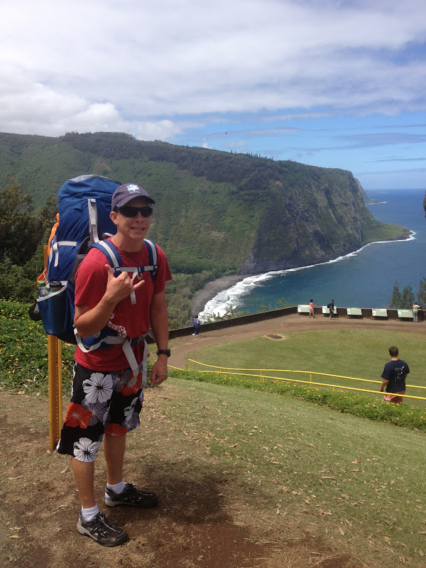
My husband, on top of Waipio. We got a lot of crazy "Are you seriously doing this" looks/comments from those huffing to the top just from the lookout to the parking lot. We knew we were a little crazy but, wanted to see what was in the valley.

Being so stretched for time, we decided to hike down the scary Waipio trail. It's been written that if this road was maintained by the government, it would be THE steepest road in the USA, the pictures just don't do it justice. 4 wheel drive vehicles are the only ones that can do this drive, you don't HAVE to have a 4 wheel drive, but if you don't the picture below shows what can happen to your car. With a 25% grade and 1,000+ foot change in elevation in such a short amount of distance, if you trip you're going to just keep rolling down the hill.

 This car remains in the woods as a reminder to those who think their cars can make the drive.
 Here is what the road looks like from the other side of the valley


30 minutes later we made it to the black sand beach at the bottom of Waipio valley. Little did we know the roughest part (and the scariest ) was yet to come.

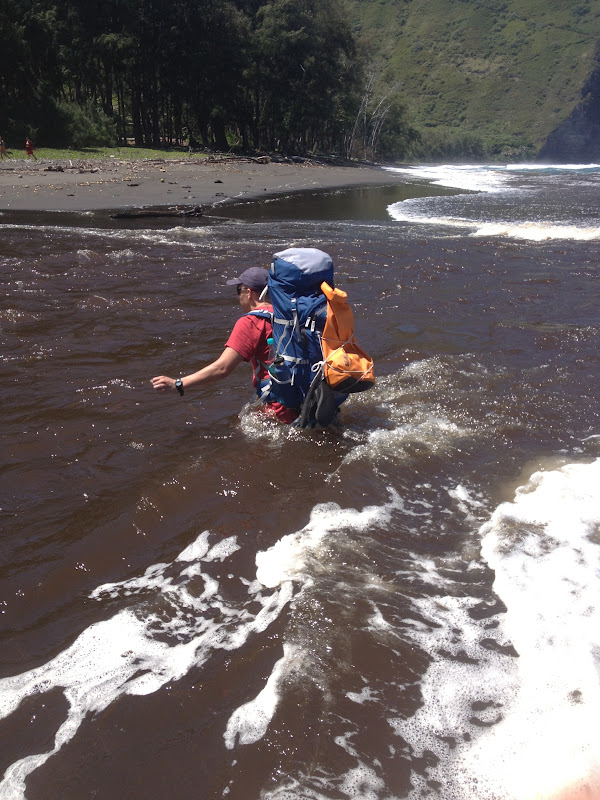
There is a crossing you must pass in order to get to the other side of the beach. From above it didn't look very bad at all. We didn't realize how rough it is until Josh took the first plunge. The tide was very high and the current...well.. lets just say it took my feet out from underneath me. The bottom of this crossing is not black sand, but lines of big boulders that are very slippery. My bag weighed 20-25lbs and so Josh came back for my bag and two men had to form a chain to help me across. As I got halfway across the path a strong wave came and took my feet from underneath me, luckily I was still holding on to one mans hand and he pushed me towards the other man. It took us about 15 minutes to get across and lost about 100 calories in adrenaline..... Malama (respect) the ocean for her forces are stronger than yours LOL

After we FINALLY crossed, and my nerves calmed down, we treked down the beach (that never ends) and found a path that led us to what is called "the Z trail"
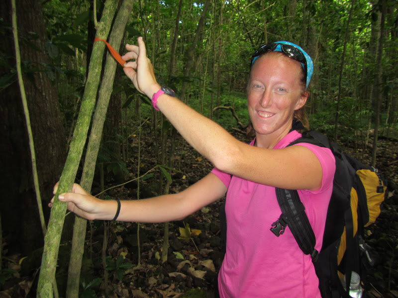
If you look closely the trail makes a faint Z that is visible even from the top of the Waipio lookout (hence the name). Only when we were coming back did we discover the marker for the beginning of this trail had a big white pole and and orange ribbon(pic below) ( I owe that to being still in shock from the river crossing)

Once you find this, it will lead you toward the mountain and you will come upon a sign
go right onto the Waimanu trail (....duh)
This begins the actual hike into the Muliwai trail (Waimanu hike). This trail is VERY,VERY well marked. Whoever comes through their and keeps up with the maintenance is amazing.
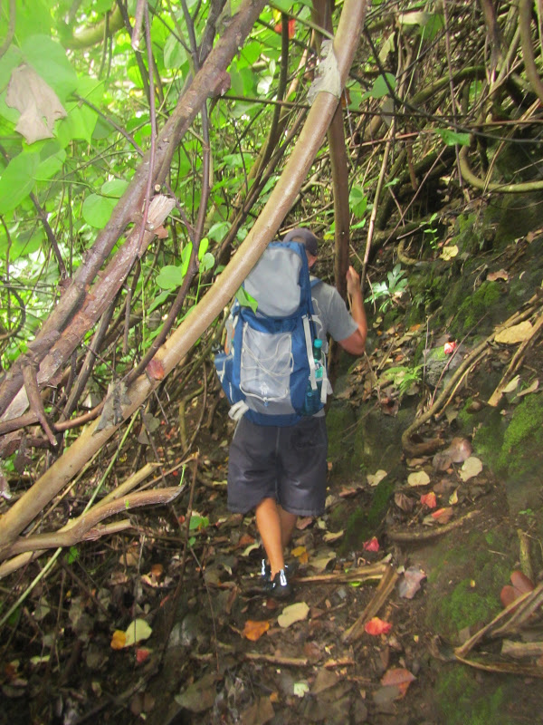
The next part of the trail is pretty strenuous. We spent the next hour climbing over boulders in direct sunlight (we felt as if we were in Arizona). The hike is somewhat a pain but the view of Waipio is amazing. You are able to see deeper into the valley than you can from the lookout. We took an nice  water break at the top.


 It was pretty amazing. Hiker's tip- this is THE LAST area for any cellphone signal (we actually skyped with my parents up here) SO...do what you need to and go ahead and put your phones into airplane mode...because you won't be getting any service soon.

This hike was a great representation of just how diverse the big island is. At the beginning we were in lush forest, then hot, dry, Arizona like, then as well climbed in elevation we were in a wooden pine tree forest.

Being from the mainland, we have discussed how we really missed fall, however there were SO many orange and brown leaves it made us feel like we were in eastern TN around the Gatlinburg/Pigeon forge area.

As stated before there are 9-10 "rivers" that you have to cross on this hike, most of them being in the wedge of the valleys. Depending on the type of weather the mountains have recently encountered these can be from little trickles to rapids. Luckily most were boulder hoppers, one being particularly beautiful

Ta-da what a beautiful waterfall, a perfect place to rest and enjoy a snack.

Along the way (as previously stated) there are 4 Helipads. I don't know if helicoptors used to land here because there wasn't much room or a platform for one to land? BUT they did have mile markers on them so, it was easy to see how far we had come, and how much farther we had left.

By the time we reached the 2nd helipad, we estimated we were going about 2.3-4 miles an hour, not bad considering how much weight we were carrying (Hikers Tip-Packing tips later in the blog) and we would just make it by sunset if we continued the pace.


By the time we got to this marker we got So excited and knew we were close, unfortunately it would take us another hour and 15 minutes to get past the .9 miles. We had to hike the Z trail down into Waimanu valley.

First view of Waimanu valley!

 This was the 2nd scariest part of the hike. I felt a little bit better because at least at this river crossing I had something to hold on to! The current was pretty strong and again lined with big bolders. I went very slow. Right after this picture was taken, there was a big dip and the water was up to the bottom of my pack, above my thighs. On the return trip I actually slipped and my feet we behind me with the current. I held on to the rope, using all my upper body strength, and just tried to get across safely....eek!


The trip (and the last river crossing) took us about 6 hours and 10  minutes! We were very happy with our time. We extremely heavy packs, we still managed to make really good time.

The camp sites are numbered and when we signed up for our permit (hikers, yes you have to have a permit) we signed up for campsite 7. There was only one other guy in the valley, SO we just ended up picking the one with the best view and figured if someone came later we would move


Our site, #2

relaxing


The sites are pretty spread out. #1 and 2 are closest to the entrance of the camp, while 5-6-7 are a pretty far walk, but closest to water.


The camp does come with 3? (or 4) elevated outhouses
 The first night we arrived we could not start a fire because it had rained all day. Thankfully we brought a little camp, oil burner and made a fantastic dinner of ramen and hot chocolate.

Good morning!

We counted about 13-18 waterfalls (you can see a lot of them in this pic, but it was beautiful!)

We spent the morning taking pictures and playing on the beach


 Afterwards we knew we needed to replenish our water supply. We had heard of a natural spring with a PVC pipe. The other camper in the valley pointed us in the right direction.
(Hikers- Hike all the way to the other side of the valley, there is a sign that says *Do not enter*, ignore it and hike into the trees. You hike for about 10-15 minutes and when you come to the first little spring, hike up the mountain and you will see a waterfall with a PVC pipe attached to it).


We brought iodine tablets that clean the drinking water. The packet said to allow for 4 hours before drinking.. so we used 5 bottles for drinking and 1 for cooking. Boiling it would clean it as well. On our way back we gathered palm trees prawns and dry wood for later to start our fire. After a breakfast of poptarts, hot chocolate, and oatmeal we packed up our water and decided to hike to the closest waterfall.

(Hikers- you keep going like you're going to this natural spring but don't go up to the water.)....The trail was really well marked...funny enough we didn't realize it until we were headed back from the water fall.

Scary side of the mountain

 The trek to the waterfall is about an hour and half long. We didn't swim in it because it was SUPER windy and cold. If we would have made the trip to the island just for this hike, I would have tho.


So in the picture above are the markers I was talking about. From the fresh water stream area to the waterfall are pink/blue/ and orange markers on the bottom side of the mountain. We zigzagged the entire way to the waterfall but once we started walking back I noticed these things made a straight path. I made a fun game out of it, calling out the colors every time I saw one off in the distance. Sigh, the joy of doing everything the hard way first .

After we came back from the waterfall excursion the sun finally came out and we relaxed on the beach .

Little did we know what was waiting for us at the beach

hello!


Josh trying to crack open a coconut

I wanted to yell "WE HAVE FIRE"....from Castaway :)

As we were making our fire, we heard a noise near the ocean. A couple,our age, had also made camping reservations. They were very sweet people from Kansas. We showed them where to get water and later shared our fire, and hot chocolate, after the sun set. 
There are coconuts all over the place and guava trees on the trail down to Waimanu, it was an amazing feast provided by mother nature :)

 The first night in the valley was calm with a little bit of a shower. Our rainfly on our tent only covered horizontally (poor design) so..halfway through the night our heads and feet were getting sprinkled. We ended up just shrinking into the feetle position to avoid getting wet. Halfway through our 1st full day we noticed a tarp that was left by old campers. 30 minutes before we went to bed we draped the tarp over our tent and put rocks on the corners to keep it from flying away...BOY am I glad we did!... We had a CRAZY rain storm come through, our tent was rocking back in forth, we would have been soaked for sure! However we were very dry in the morning!

After refilling our water bottles, and eating breakfast, we packed up and started hiking out... again.....Crazy river-2, Lori-0. As stated earlier, my legs got swept out from benethe me. I was kicking...and swimming, holding on to the rope relying entirely on my upper body to hold on to the rope. I finally made it and we continued on UP the crazy Z trail. 


The climb out was pretty steep and wet which made it difficult. After the 9-10 switch backs we finally made it to the top and continued our journey.

The time went fast as we spent most of our hike talking and before we knew it we were back at the Waipio Z trail.


We took one last look and continued our descent. 

Upon reaching the black sand beach Josh couldn't help but play with a friend he found on the beach


Again, we were met with a raging river that we had to cross. This time I picked up a very long stick and used it to hold my balance. It still took me about 15 minutes to cross, because I was going so slow, but my feet stayed on the ground and I didn't float out to the ocean.

While hiking up the Z trail in Waimanu we ran into a guy that asked us about the waterfall. Supposedly he ran the entire way back and met us at the river crossing. After he crossed he GRACIOUSLY offered us a ride back up the Waipio valley road. He saved us a ton of leg work and probably and hour and 1/2 of our time.

The guy let us ride in the bed of his truck. His tailgate was open and because of the steepness of the road is I had to prop my foot up on a bar to keep from sliding out..

This was our last view into Waipio as we road out.

It was an amazing hike/camp. I'm so glad we did it :)

This page is already very long winded, SO i'm going to post a Part 2 for hikers tip's, a packing guide, and things we discovered in Pt 2.

Thanks for reading!